Saturday, March 30, 2024

Run 159 - Saturday morning in the Heights

March 30, 2024

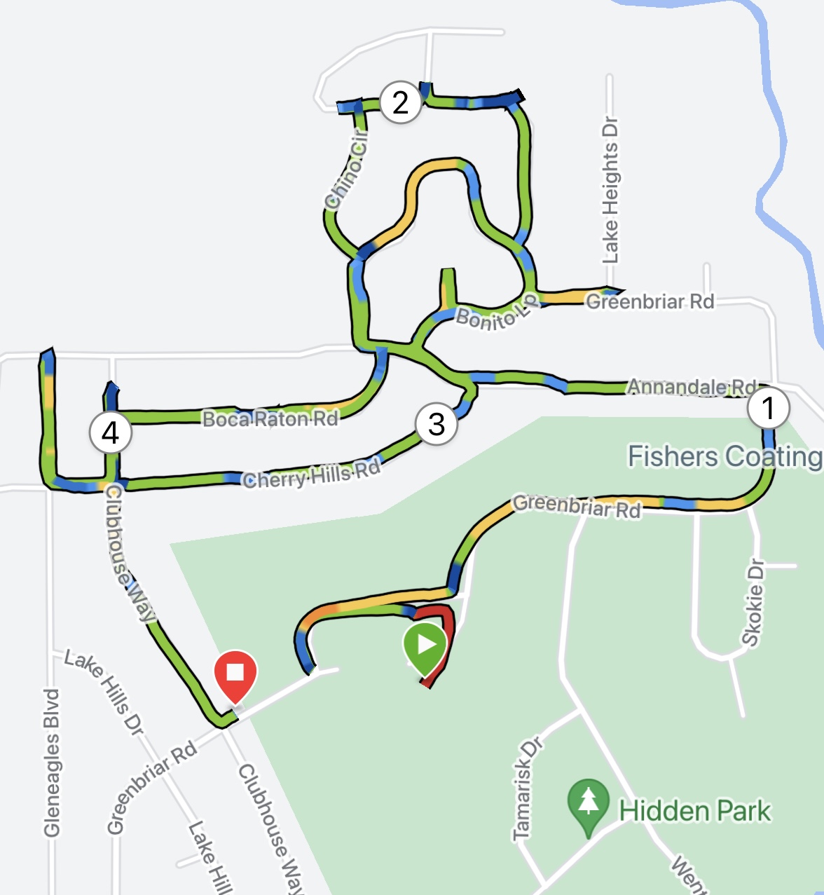
It’s another Saturday morning run and it’s back to Billings Heights to work through some more streets for this project.  Shelley and I were joined by Katie who ran some of the mid-town routes for us last year.  We met at the Skyview High School parking lot at 7:20 and set out on this route:


Of course the map doesn’t show it but it’s not all flat out there.  The weather was a chilly 28° at the start with a bit of a freezing mist but unlike last week the sidewalks and streets were free of ice.  About 3/4 of the way through the run it started snowing.  I like these conditions much better that any heat over 68°.

It’s not really a photogenic route but I did take a few photos.

This first one is unusual for the Heights as it’s rare to see anything that might be classified as “yard art” in that part of town.


This is looking east on Morocco Drive,


Katie and Shelley on Siesta Circle.


A walk break Gleneagles Blvd.


The snow is starting to accumulate.  This is approaching the corner of Fantan and Sierra Granda.


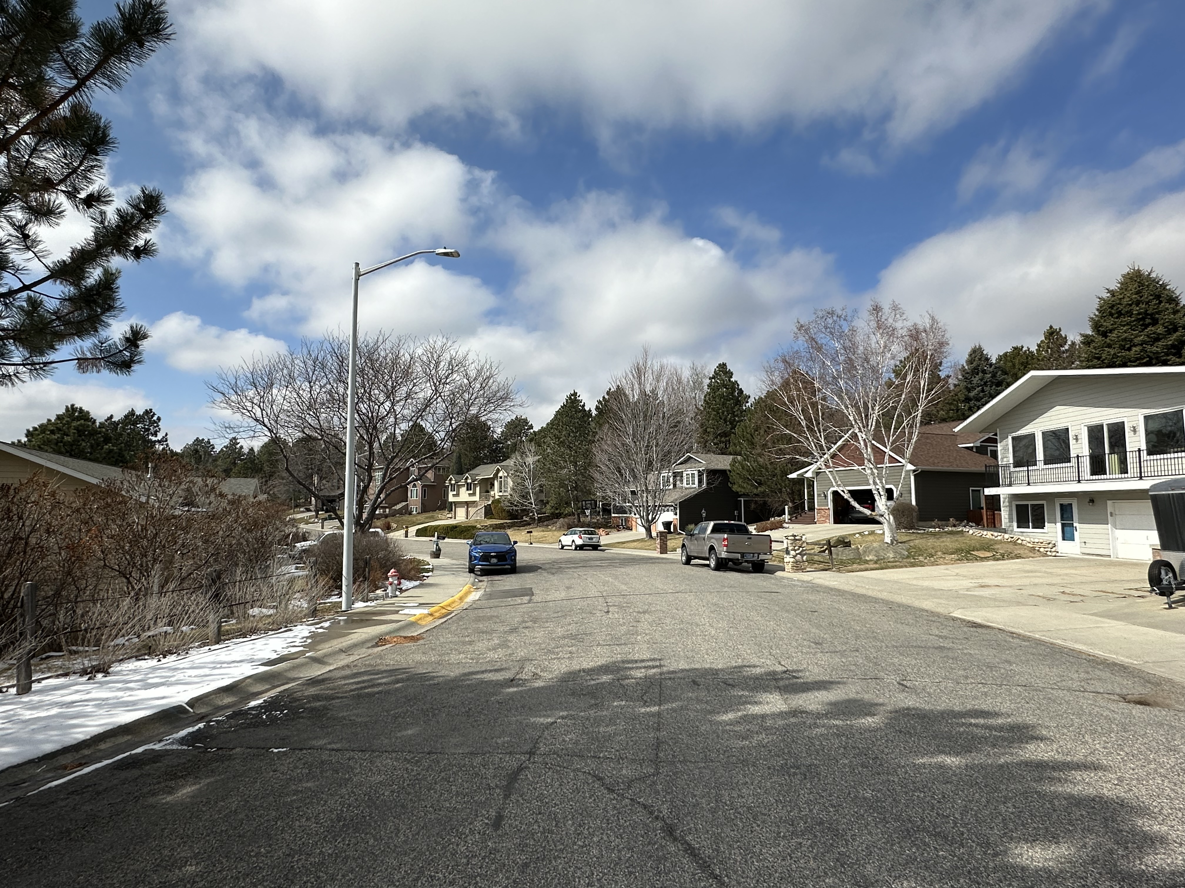
In this part of the Heights, many streets dead end like this on the north end of Morocco.


Turning the corner of Sierra Granda and High Sierra.


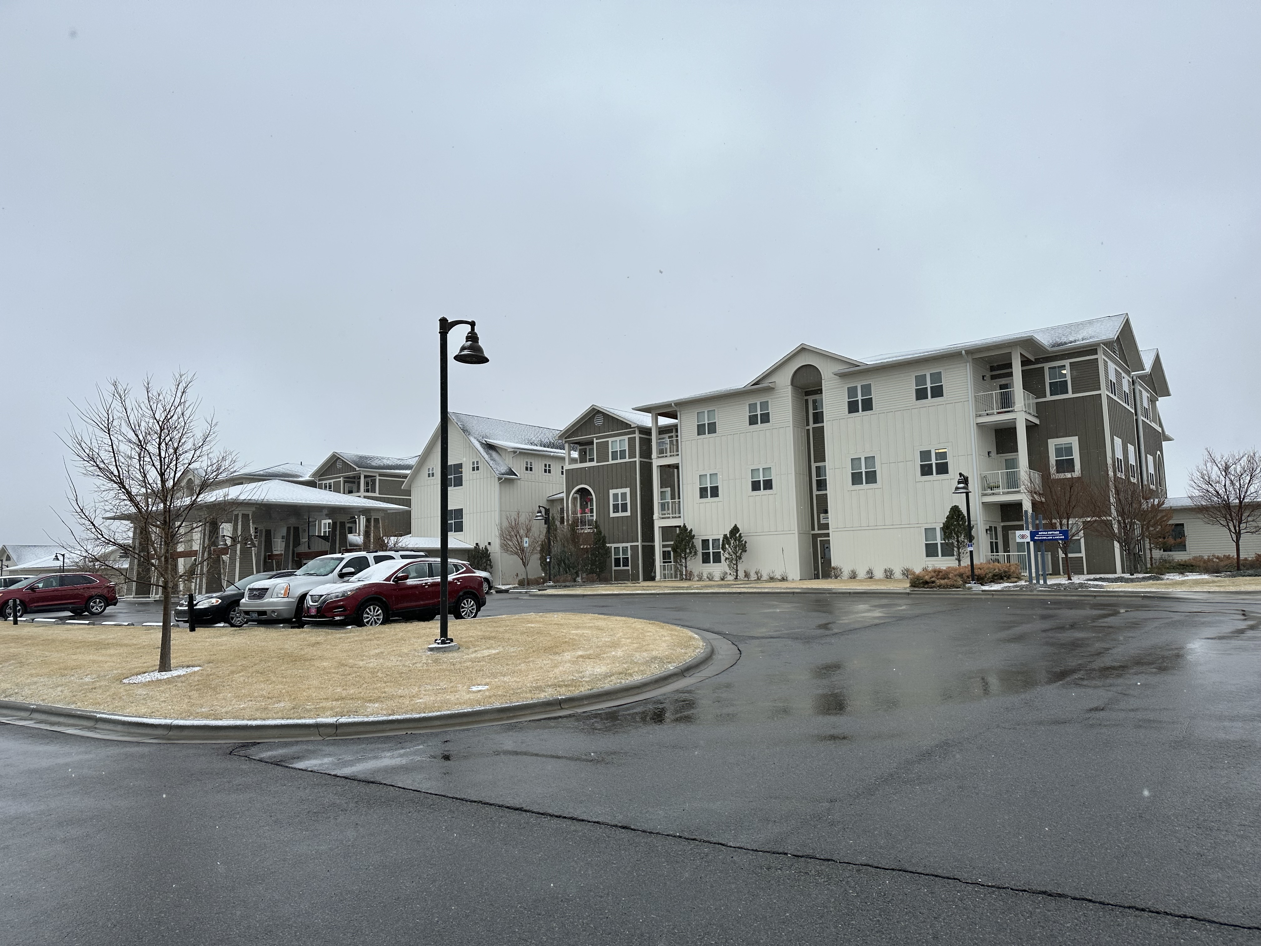
Look toward St. John’s Wyndstone facility.


Harvest Church in the background from Andele Street.


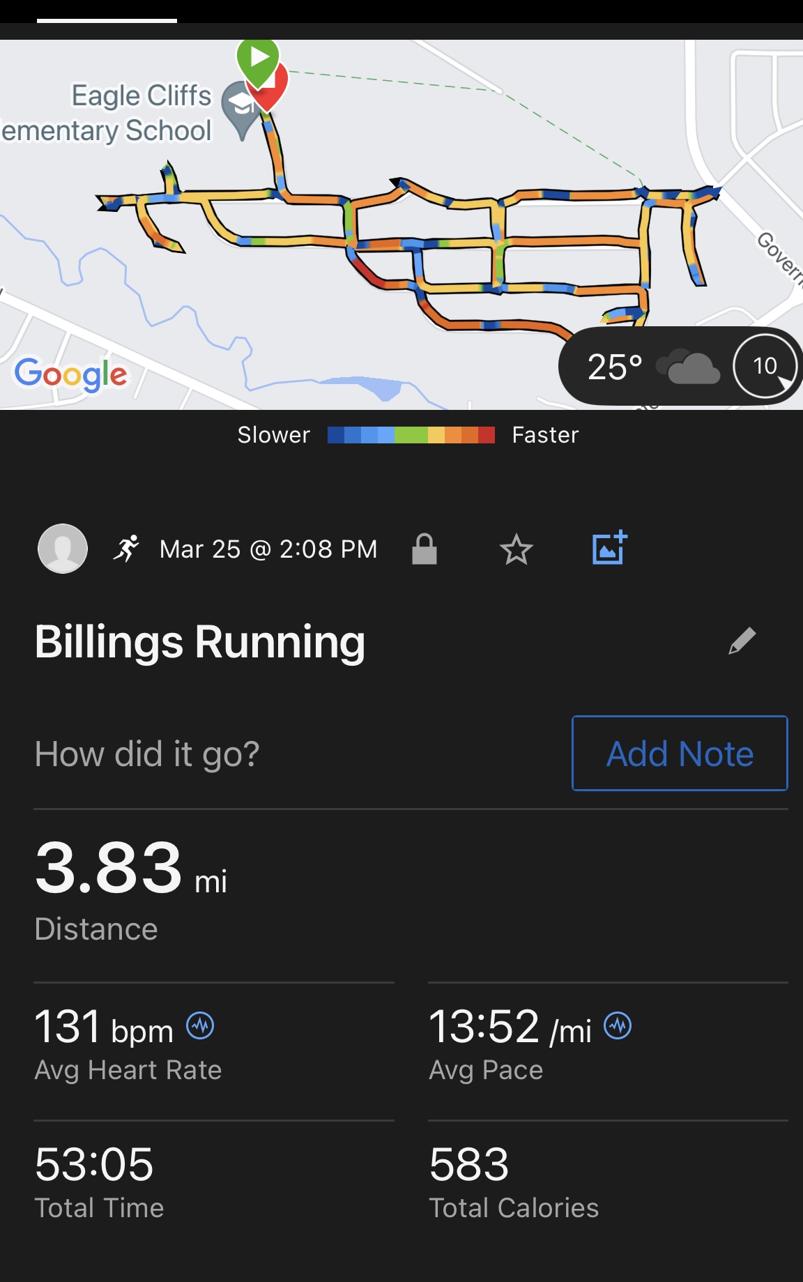
We arrived back at the Skyview High parking lot with 6.2 miles behind us.  Katie had to leave to meet some friends for a walk on the Rims but I gave her some of my fresh-baked cranberry scones before she took off.  Shelley, who is still training for a half marathon, wanted to do 2 more miles and since I’d made a map for that, off we went.  Here’s the route:


This will take us through streets we haven’t done yet and introduce us to a new neighborhood that is northwest of the school.  Here’s the front of Skyview High.


We were getting near the end when I took this photo.  That the Lutheran church on the left and the Wyndstone facility on the right.  We are near the corner of West Wicks and Siesta.


Wyndstone.


We went around the north side of the school and through some trees to where we could see the parking lot.


Not a bad distance and we felt pretty good.  I always like to ask myself how much more I had left and I definitely could have gone another 2  mile to give me a 10-miler.  These 8 mile runs are getting me back in distance shape.


A side note:  We traveled from my house to the school and back with the new version, 12.3, of the Full Self Driving feature in my Tesla MY.  It handled 98% of the drive there and back without issue.  A great upgrade.


Friday, March 29, 2024

Run 158 - North end of the Heights

March 29, 2024

It’s a beautiful Friday, although a bit cool and breezy, but nice enough to get another 4 miles of streets in the Heights covered.  I looked at my master map and saw that the area above the golf course needed finishing of so I designed a 4 mile course.  Once I got there I found that some streets had been added so I ended up with a little extra distance.


I parked on Greenbrier near the golf course and headed east.


The road that my map indicated might be there is there but not yet paved.


New roads going in.


On Winged Foot Road.


Now that the new houses and all are in they are coming back for utility work.


A new street on the very north end.  This is Bonito Loop and there are two of them, one inside the other.  That didn’t show on the planning map so this is where the extra .6 mile came from.


With houses looking so similar this is like looking into a mirror that is looking into a mirror.


I was noticing the cracks in the street and how many of them are associated with spots like this.


This is as far north as Clubhouse Way goes.


That was it.  A pleasant enough outing.  There more streets to cover near here and I should have those done in the next few weeks.


Monday, March 25, 2024

Run 157 - Around Eagle Cliffs Elementary School

March 25, 2024

I usually try to get a run in on Mondays, but shorter as I have a longer run planned for Tuesdays.  Today seemed like a perfect day to run the streets near Eagle Cliffs school as I’ve covered everything else that connects to that neighborhood so it’s an “leftover” and it would give be about 4 miles. We’ve had some cold weather and snow but by noon it had cleared up a bit.

The route plan:


First off, let me say that like many of these runs this will take me down streets I’ve never traveled before and as I went through them I was pleasantly surprised as the houses were not the usual Height-splits-entry types.

I parked at the school.  It’s quiet as its spring break.


The school is almost surrounded by open, state land.


Looking back at the school from Constitution Avenue.


The out and back on Looking Glass Drive and the first hill of the day.


From the top of Looking Glass looking west.


Looking down Looking Glass.


A view from the west end of Kootenai Ave. looking over Alkali Creek.


A house on the west/dead end of Kootenai.


Looking east on Calico.


A different type of architecture.


And across the street is a nice big one.


A view down Senora Ave.


Nothing built here.


A city park viewed from Capricorn Place, near Constitution.


Constitution and Governors.


The next 34 images were on Constitution looking north onto the swath of state land.


Looking north from Constitution and Fantan.


Nice brickwork.


From the end of Constitution looking north.


That was it.  A shorter and pleasant run, a nice way to spend a Monday early afternoon.


Run 169 - North and east of Primrose Park in the Heights

April 30, 2024 It was a beautiful morning after a light rain over night.  Shelley and I met up at Primrose Park at 6 am to work on this map:...